
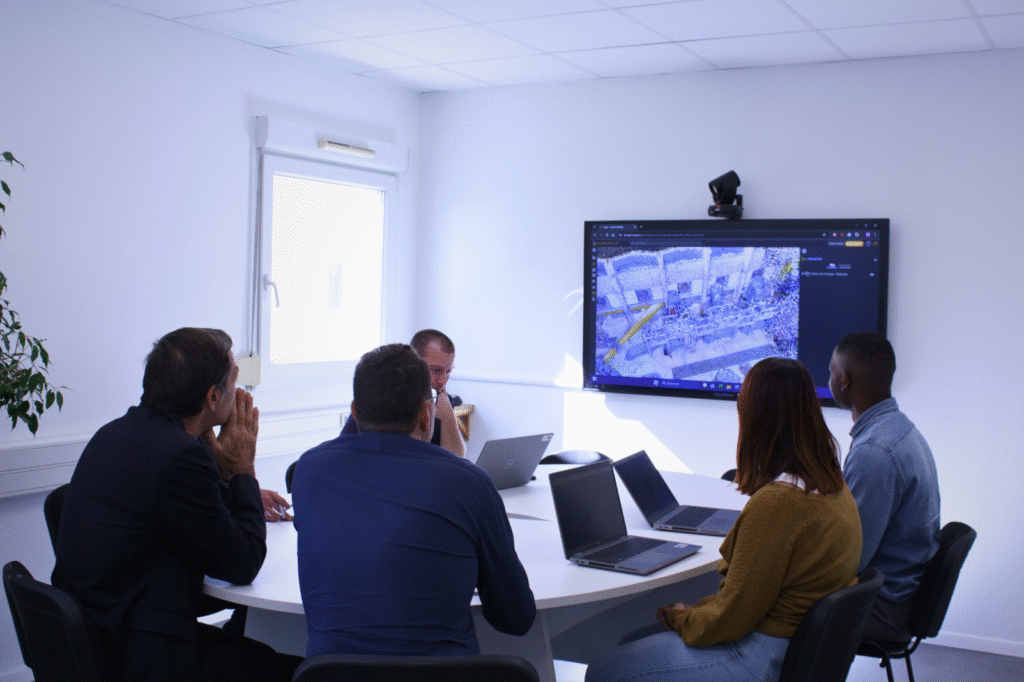
"The Shared Reality platform has enabled us to rapidly provide our teams and subcontractors with an up-to-date 3D view of our facilities, streamlining cost estimation, site preparation, and supporting the onboarding and training of new staff.
Beyond delivering a region-wide digital representation, the solution allows for the progressive enhancement and validation of the data used in our maintenance and asset-management systems, while helping us compensate for the lack of technical drawings and operating schematics on our oldest sites.
Much like the deployment of our geographic information system (GIS) for networks ten years ago, implementing Shared Reality now allows us to manage the technical data of our production assets more effectively at a time when our infrastructure must rapidly adapt to the realities of climate change.
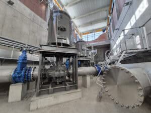
"We wanted to create a GIS equivalent for our production facilities.
Thanks to 3D scanning, we quickly obtained accurate digital models of our facilities.
Thanks to 3D scanning, we quickly obtained accurate digital models of our facilities.
Samp's AI enabled us to transform the scanned point clouds into different known equipment, ready to be linked to our business systems.
We were impressed by this product, which is practical, fast, and allows our teams to build BIM models that can be interfaced with our operating tools.
